PICS: Pseudo-Invariant Calibration Sites
- text
-
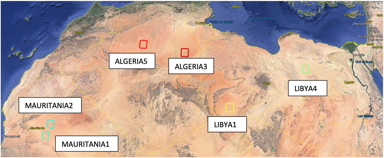
Pseudo Invariant Calibration Sites (PICS) are terrestrial sites used to monitor the long term in-flight radiometric calibration of Earth Observation optical sensors. They are used intensively by spatial agencies since long time now because they are spatially very uniform, stable spectrally and invariant with time. A long site of these sites has been identified. They are mostly located in the Sahara desert and Peninsula Arabia. USGS catalog lists most of them.
Among these sites, six have been endorsed by CEOS as standard reference sites for the post-launch calibration of space-based optical imaging sensors in (CEOS IVOS-19 Meeting, Phoenix AZ).


Projects related to PICS usage
PICSCAR
A CEOS study held by CNES and Magellium has been initiated to facilitate coordination and help prioritize research on PICS and their usage for the benefit of the EO community as a whole. Information on these six PICS has been collected. Tools to monitor the stability of sensors using PARASOL BRDF is available. Radiometry monitoring of Landsat 8/OLI vs S2A/MSI sensors over Libya 4 site is updated each 6 months and results are made available to users. Please refer to the PICSCAR web site for this activity
PICSAND
An ESA study aiming at improving the surface and atmosphere characterization of the PICS has been led by NOVELTIS company supported by ONERA (Office National d'Etudes et de Recherches Aérospatiales) and LSCE (Le Laboratoire des Sciences du Climat et de l'Environnement). Such characterisation data are made public to support the reduction of uncertainties in radiometric monitoring methodologies. The study consisted in:
- Revisiting the list of Pseudo-Invariant Calibration Sites (PICS) over desert areas defined by Cosnefroy et al. (1997) based on recent multi-spectral remotely sensed data with enhanced temporal and spatial coverages and resolutions, focusing on site scales of 20 km and 100 km spatial resolutions.
- Collecting sand samples from an ensemble of identified sites.
- Analysing in laboratory their physical (mineralogy and grain size analysis) and optical (spectro-directional reflectance) properties.
- Assessing the performance of several BRDF models to fit sand spectro-directional measurements don in laboratory as well as surface reflectance derived from the POLDER/PARASOL space-borne instrument over the PICS.
- Building a database combining the sand spectro-directional measurements of the samples collected in this study and other similar measurements available in the literature.
- Determining a climatology of aerosol and atmosphere conditions over the PICS supporting modelling studies of the top-of-atmosphere (TOA) signal over the PICS.
In the frame of the ESA-PICS study, the PICSAND database of sand optical properties has been built and made available online on the PICSAND portal. The final reports of this study are available here: PICS Reports
